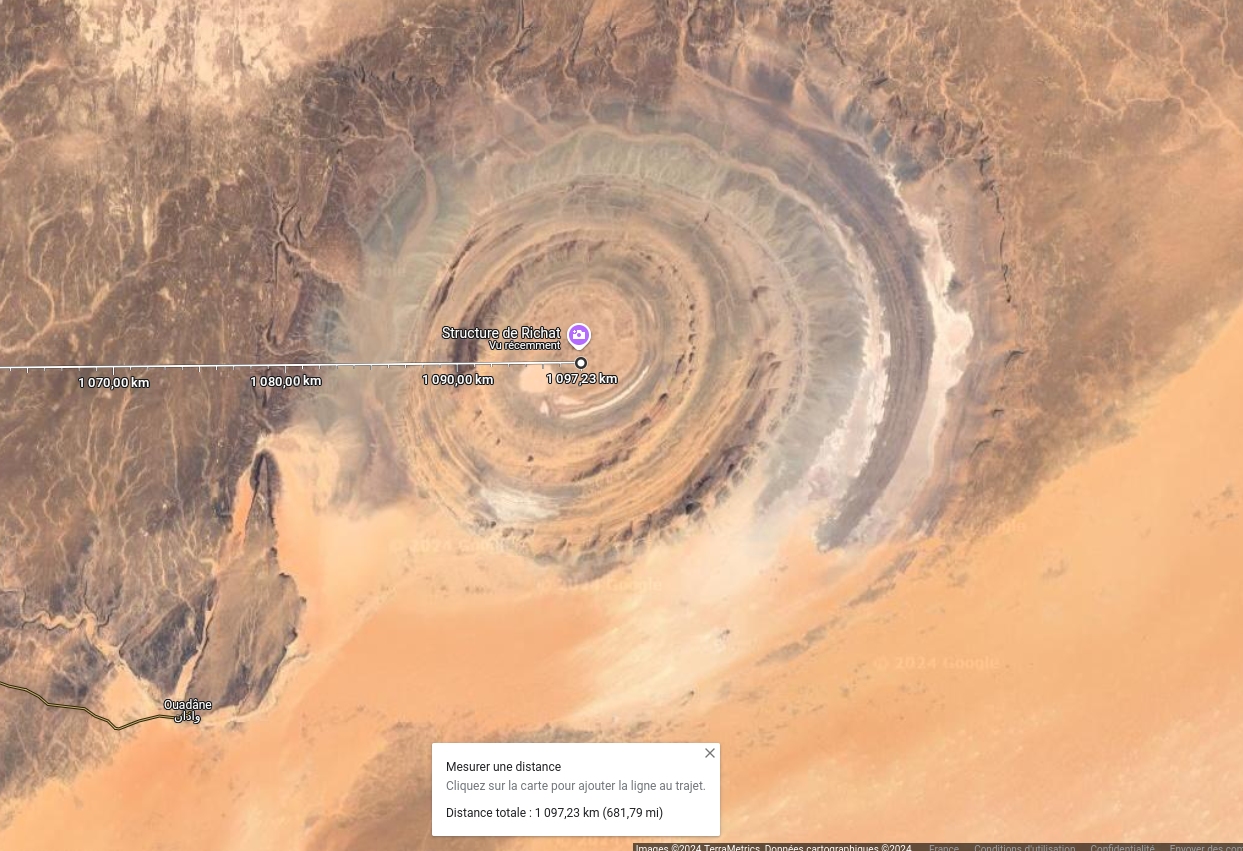
the Structure_de_Richat
is located at the same latitude
that the south summit-west of the hexagon and at a distance of 1097 km, a difference of 14 km.
compared with the 1111 km ridge, a difference of 1.
2%, which, taking into account
that have disrupted the structure is surprisingly close.
The geographical coordinates of the Richat structure are : 21°07′26″N, 11°24′07″O.
A 10° longitudinal displacement from the south summit-west of France.
the Richat structure has an estimated diameter of 50 km, i.e. a longitudinal line of 1111 km from the southern summit-of the hexagon still falls within the Richat structure.
The myth of Atlantis has given rise to countless controversies..
Some believed that Atlantis had really existed, others that the story was an invention of Plato's, but was based on theories of the time.
others have seen it as an allegory of the true story..
proved that a vast collapse occurred at the end of the Quaternary Age west of the Strait of Gibratar..
see the l_atlantide_de_pierre_termier_txt_en in this passage analysis_by_Pierre_Termier_of_the_slaves_received_in_the_Acores_marine_beds_in
where the existence of glassy basaltic lava shows that cooling took place at atmospheric pressure.
otherwise the pressure at a depth of 3,000 metres would have caused the lava to crystallize..
- In Plato's book Critias
this description of the Atlantean capital can be found on page 28:
This is how Poseidon, having shared the island of Atlantis, settled the children he had had with a mortal woman in a place on the island that I'm about to describe..
On the seaward side, a plain stretched across the middle of the entire island, a plain that is said to have been the most beautiful of all plains, and fertile enough to support a wide range of crops.
par excellence.
Towards the center of this plain, at a distance of about fifty stadia, we saw a mountain that was everywhere of mediocre altitude..
On this mountain dwelt one of those men who, in this country, were originally born of the earth.
They begat an only daughter, Clito, who had just reached marriageable age when her father and mother died..
Poseidon, having fallen in love with her, joined forces with her and fortified the hill where she lived, cutting out the perimeter with enclosures.
made alternately of sea and land, the larger enveloping the smaller.
He drew two on land and three on sea and rounded them off from the middle of the island, from which they were at equal distances everywhere, so as to
make the passage impassable to men ; because in those days-here neither ships nor navigation.
Lui-even embellished the central island, an easy task for a god.
He raised two springs of water from the ground, one hot and the other cold, and made the earth produce varied and abundant food..
Using Google Earth, we can see that the relief of Richat's structure has the same shape as the center of the structure,
two concentric zones of maximum altitude, separated by depressions.
As a reminder, according to Plato, the sinking of Atlantis took place some 12 to 13,000 years ago..
On page 19 of the same text :
First and foremost-that, all in all, nine thousand years have passed since the war that,
according to the revelations of the Egyptian priests, broke out between the peoples who inhabited the-outside
by-the columns of Heracles, and all those who lived beyond them.
 The angle at the north point-west is not 60°, but the north ridge-west is deformed by the relief that was not present when the hexagon was formed.
 The completely visible western edge, 1111 km long, is perfectly straight and follows a meridian, which is quite extraordinary and supports the ancient definition of the metre, as do many ancient artefacts on the planet..
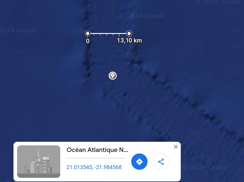 From this data, we can deduce the hexagon's shape.
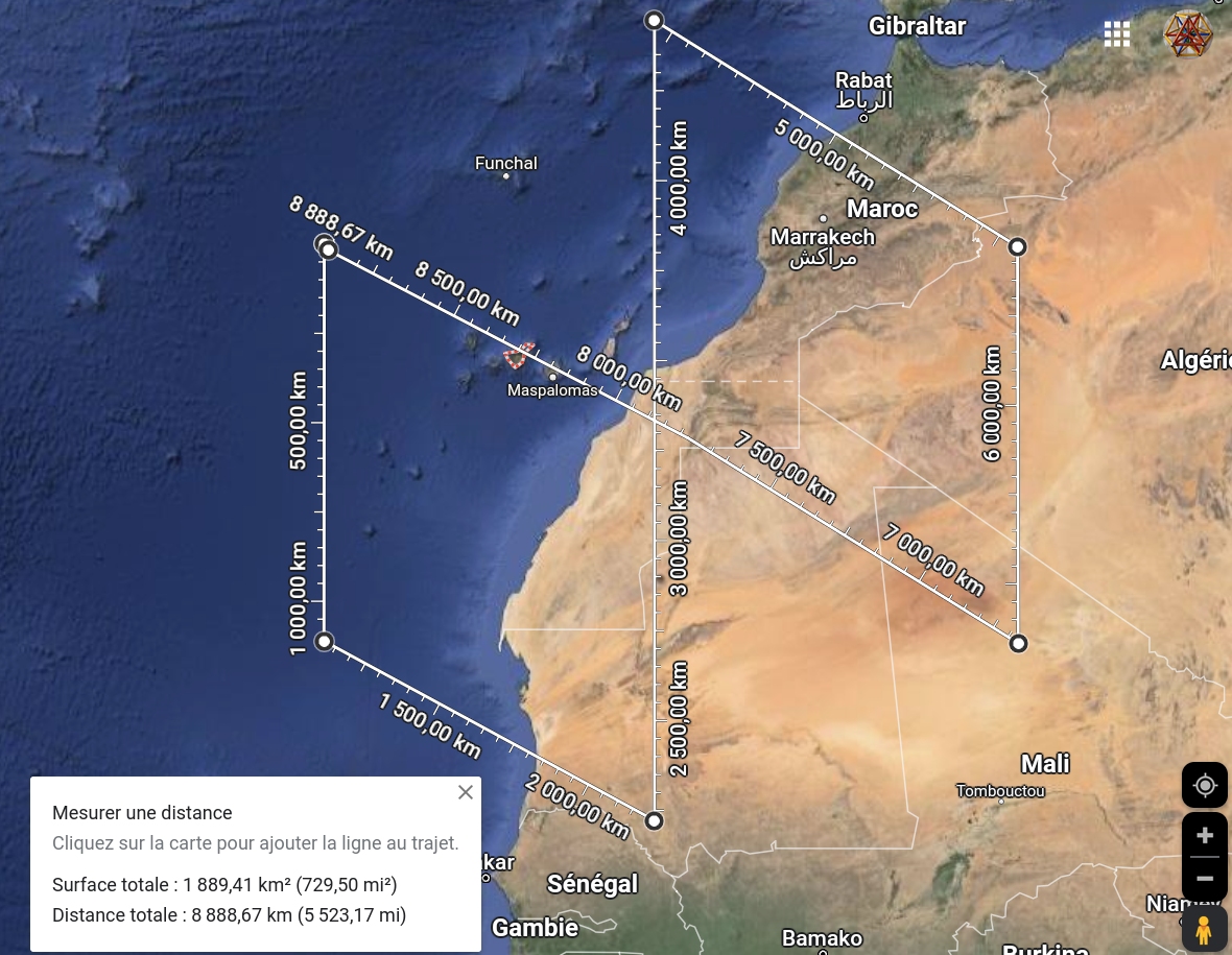 France is known by the name of the hexagon. If we roughly draw the French hexagon, the side is about 500 km long. (so possibly 555 km)
half the size of the Atlantean hexagon
France is known by the name of the hexagon. If we roughly draw the French hexagon, the side is about 500 km long. (so possibly 555 km)
half the size of the Atlantean hexagon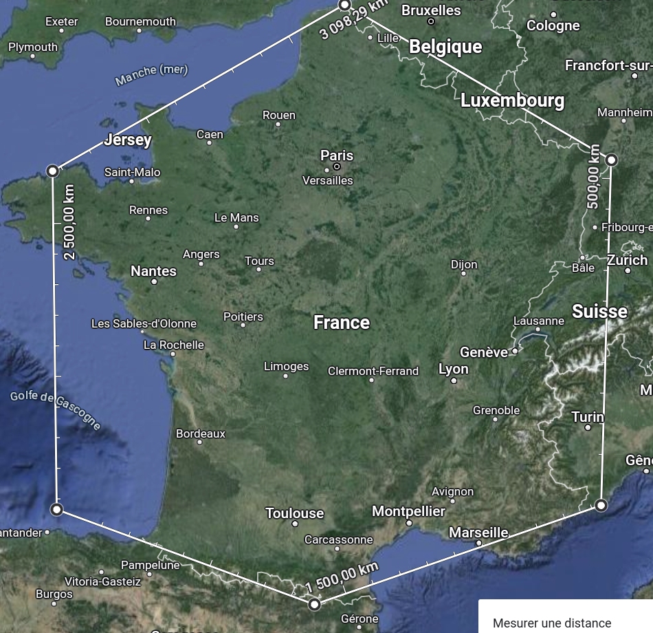 Is there a link between the France that restored lost unity and Altantide? Some answers can be found here :Didier_Coilhac_l_atlantide_et_versailles_1_2022_10_01
1.1.Coordinates hexagone atlante
Is there a link between the France that restored lost unity and Altantide? Some answers can be found here :Didier_Coilhac_l_atlantide_et_versailles_1_2022_10_01
1.1.Coordinates hexagone atlante